
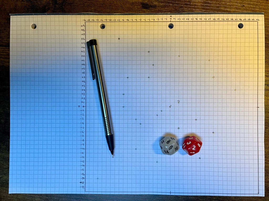
If there is one thing that my experience with Fellmyr has taught me it’s that mapping out the initial play area does not need to be complicated or look pretty. I also learned that having an A4-sized GM map is an excellent tool for running a useful campaign in the early stages: A4 is portable and easy to reference. As it happens, I have a pad of square-ruled 5mm A4 paper on hand, so I am going to grab that down. The only minor annoyance is that it has drilled pages but I’ll not let that stand in my way.
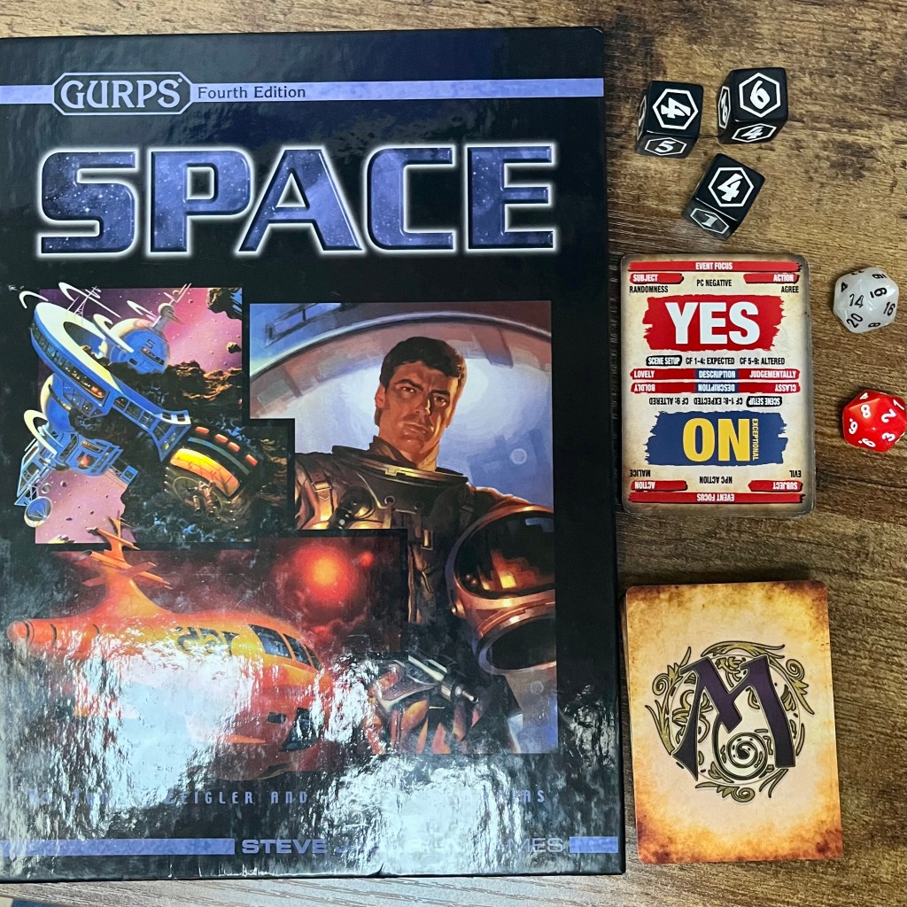
The A4 page allows for a 20cm square area – because I figure that star mapping in cubic sectors makes some sense – and this allows for a 40×40 area of 5mm squares where the intersections of the line mark possible star system locations. GURPS Space (1988) suggests a scale of 1 parsec per 1/4 inch square, which is roughly the scale I am working at in metric. This seems cool. Next comes the question of how to best populate the map. Honestly, even though there are suggestions for dicing it out, I am opting for the “easy way”:
“…close your eyes and mark the map twenty or so times – each mark will be an important world” (GURPS Space, 1988, p99)
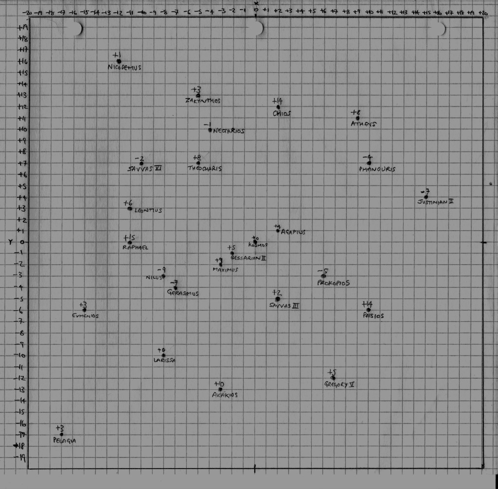
This process creates an interesting distribution of important star systems and triggers two thoughts: a) that the layout just happening to include (0,0,0) as an important world suggests the heart-world of the Federation lies there; b) that if the Federation controls the maps then there could be other valuable worlds out there not on the publicly-available maps. Given that there will be many thousands more stars in a 40x40x40 parsec area of space and the map only highlights key systems, there’s a lot of “white space” to hide secrets inside. I decide to add five extra systems to connect a couple of points and add some far-flung worlds to make it more interesting.
Reminded of the material around the birth of the Third Imperium in Traveller, something that I have long admired from the T4 Milieu 0 setting (1996), I like the idea that the homeworld of the Federation lies in the centre of this sector of space. This suggests the surrounding 26 sectors are all ripe for exploration should the players opt for a Scout-based campaign. If not, the systems mapped present an interesting spiral of stars to play within. Twenty-five initial worlds is a good place to begin.
I initially feel like a Warp Drive speed of 1 parsec per week feels about right. I’m minded to place the four central worlds into the Federation proper and allow the game to expand from there. That means you can fly across the sector in about 20 weeks but I am probably going to place some fuel limits on that pace to make sure starships need to stop en-route. I might revisit those numbers as the details take shape, but it’s a simple to grok starting point for now.
Before I take an initial scan, it occurs to me that I need to generate the Z-axis position of all those star systems. Given a 20-parsec +/- range in the cube of space, I figure that rolling 1d20-1d20 will generate a decent range of coordinates. I can simply annotate those numbers right onto the star map and then take it from there. Inspired by the GURPS Space Atlas (1988), I decide to generate a table of distances between all 25 stars to help with navigation and adjudicating journey times. Finally, I add some system names based on the names of Greek Saints of the Church and a few Greek place names.
Game on!

I love it, Che! This is really inspiring me !
LikeLiked by 1 person
Good to hear! Anything in particular you’re enjoying?
LikeLike
I like the way you are approaching the scope of the game, how you are approaching a sandbox-ish campaign. I think you are doing it right. Answering the questions that need to be answered.
LikeLiked by 1 person
Your “not complicated or pretty” map still looks a lot tidier than any of mine! 😅
LikeLiked by 1 person
It’s already done, so this is too late and only of small benefit anyway, but d20-d20 results in a bell curve that peaks at 0. You might have been marginally better off rolling d4 and d10 to generate a number between +20 and -19 (d4: 1 = d10-20, 2 = d10-10, 3 = d10+0, 4 = d10+10) or else a d6 and d20 to get a similar range (d6: 1-3 = d20, 4-6 = d20-20).
LikeLike
[…] when I used GURPS Space to knock up a sector of science-fiction worlds and got myself excited about playing around there? This was about a month before I began the recent […]
LikeLike